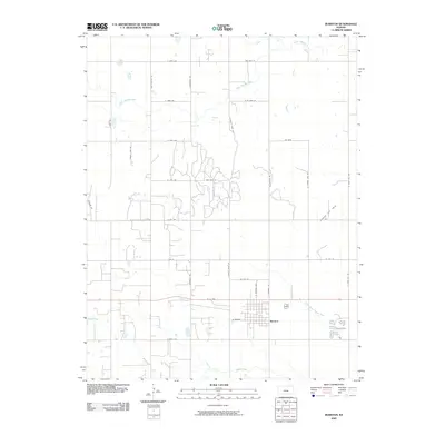
2009 Map of Burrton
USGS Topo · Published 2009About this map
Burrton serves as the central hub for this section of Harvey County, situated along the southern edge of the map where W 50 Hwy and W Market define the town's grid. The surrounding landscape is dominated by agricultural section lines and a significant industrial footprint represented by the Burrton Gas Field to the northeast. Waterways including the Little Arkansas River and Blaze Fork carve through the northern plains, while Kiswa Creek and its North Branch Kiswa Creek drain the area near the settlement. The map reveals a highly structured road network with family or place-named routes like Rayl Rd, Worthington Rd, and N Burmac Rd, reflecting the long-standing land ownership and rural infrastructure characteristic of central Kansas at the dawn of the 21st century.
Find a feature on this map
35 named features on this map. Tap any name to fly to it.
Don’t see what you’re looking for? This feature index may not catch every label — zoom into the map to look around manually.
Map Details
Editions of this 2009 Burrton Map
This is the sole edition of this map. No revisions or reprints were ever made.
Other maps of this area

1889 · Cheney
USGS Topo · 1:125,000

1891 · Hutchinson
USGS Topo · 1:125,000

1891 · Cheney
USGS Topo · 1:125,000

1893 · Hutchinson
USGS Topo · 1:125,000

1901 · Cheney
USGS Topo · 1:125,000

1955 · Wichita
USGS Topo · 1:250,000

1955 · Hutchinson
USGS Topo · 1:250,000

1958 · Wichita
USGS Topo · 1:250,000

1958 · Patterson
USGS Topo · 1:24,000
1958 · Bentley
USGS Topo · 1:24,000