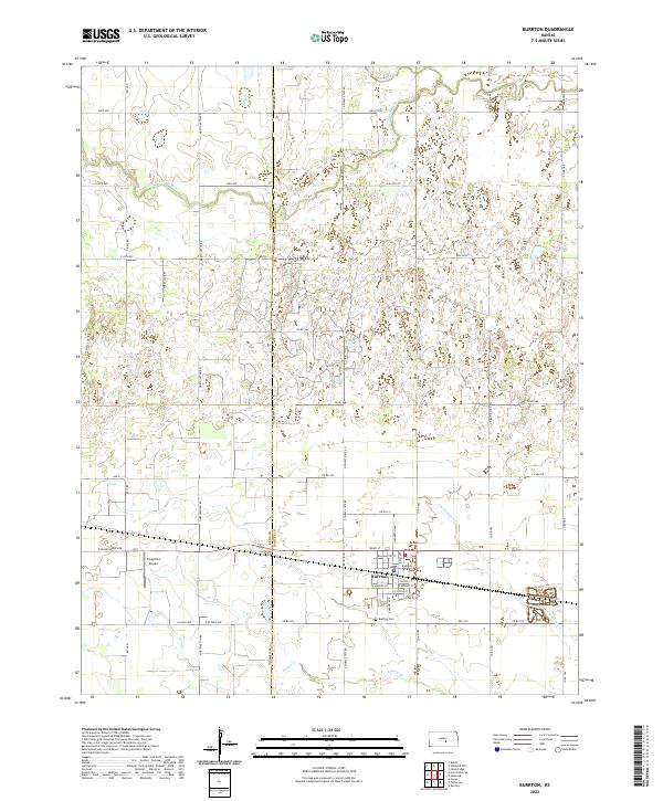
2022 Map of Burrton
USGS Topo · Published 2022About this map
Burrton serves as the central hub of this prairie landscape, situated along the border of Reno and Harvey Counties. The town's grid is anchored by Washington Street and N Burrton Ave, with the Burrton Cemetery located just to the south. The surrounding terrain is defined by a network of drainage ways and creeks, including the Little Arkansas River and Blaze Fork in the northern reaches, and the multiple branches of Kisiwa Creek to the south. A notable modern landmark, the Flugplatz Airport, sits west of the town center, highlighting the transition of land use from purely agricultural to mixed regional transport. This 2022 survey captures the modern road network, from major routes like E Blanchard Ave to section-line roads like Worthington Rd and Woodberry Rd that partition the Kansas farmland.
Find a feature on this map
52 named features on this map. Tap any name to fly to it.
Don’t see what you’re looking for? This feature index may not catch every label — zoom into the map to look around manually.
Map Details
Editions of this 2022 Burrton Map
This is the sole edition of this map. No revisions or reprints were ever made.
Other maps of this area

1889 · Cheney
USGS Topo · 1:125,000

1891 · Hutchinson
USGS Topo · 1:125,000

1891 · Cheney
USGS Topo · 1:125,000

1893 · Hutchinson
USGS Topo · 1:125,000

1901 · Cheney
USGS Topo · 1:125,000

1955 · Wichita
USGS Topo · 1:250,000

1955 · Hutchinson
USGS Topo · 1:250,000

1958 · Wichita
USGS Topo · 1:250,000

1958 · Patterson
USGS Topo · 1:24,000
1958 · Bentley
USGS Topo · 1:24,000