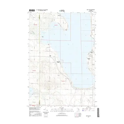
2017 Map of Burt Lake
USGS Topo · Published 2017About this map
Burt Lake dominates the central portion of this landscape, its shoreline defined by a series of residential developments and points of interest. Along the western banks, the community of Springwell Heights sits near the mouth of Hassler Creek, while the eastern shore is characterized by established lakeside areas like Chippewa Beach and Wauban Beach. The presence of the Harmon Grave and the Ohloville Cem south of the lake provides specific touchpoints for genealogical research and local history.
Find a feature on this map
93 named features on this map. Tap any name to fly to it.
Don’t see what you’re looking for? This feature index may not catch every label — zoom into the map to look around manually.
Map Details
Editions of this 2017 Burt Lake Map
This is the sole edition of this map. No revisions or reprints were ever made.
Other maps of this area

1955 · Cheboygan
USGS Topo · 1:250,000

1957 · Wolverine
USGS Topo · 1:62,500

1957 · Mullett Lake
USGS Topo · 1:62,500

1958 · Cheboygan
USGS Topo · 1:250,000

1958 · Pellston
USGS Topo · 1:62,500

1958 · Petoskey
USGS Topo · 1:62,500

1975 · Petoskey NE
USGS Topo · 1:24,000

1982 · Petoskey
USGS Topo · 1:100,000

1982 · Pellston
USGS Topo · 1:25,000
1982 · Indianville
USGS Topo · 1:25,000