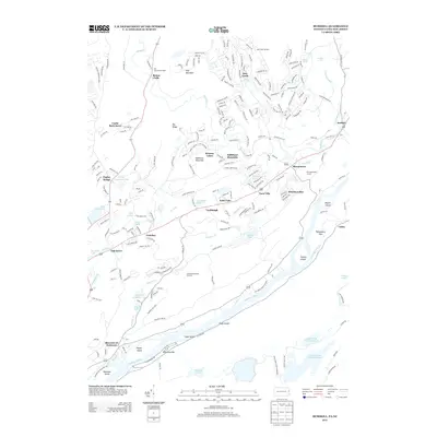
2013 Map of Bushkill
USGS Topo · Published 2013About this map
Bush Kill and the Delaware River define this Pennsylvania-New Jersey borderland, carving through a landscape shaped by water and recreation. The celebrated Bushkill Falls and Resica Falls sit at the northern reaches, while the river's bend at the south is dotted with significant river features like Tocks Island, Labar Island, and Shawnee Island. This modern survey illustrates the evolution of the area from historical river crossings to a contemporary vacation destination, highlighting developed enclaves like Saw Creek and Winona Lakes alongside the Shawnee Mountain Ski Area. Geographers can trace the historic Old Mine Rd running parallel to the river near Pahaquarry Flat, passing through early settlements such as Shoemakers and Turn Villa. The presence of the Boy Scout Reservation and numerous bodies of water like Sunfish Pond and Hidden Lake emphasizes the region's enduring role as a protected corridor for outdoor activity within the Delaware Water Gap area.
Find a feature on this map
56 named features on this map. Tap any name to fly to it.
Don’t see what you’re looking for? This feature index may not catch every label — zoom into the map to look around manually.
Map Details
Editions of this 2013 Bushkill Map
This is the sole edition of this map. No revisions or reprints were ever made.
Other maps of this area

1888 · Hackettstown
USGS Topo · 1:62,500

1891 · Wallpack
USGS Topo · 1:62,500

1891 · Delaware Water Gap
USGS Topo · 1:62,500

1893 · Delaware Water Gap
USGS Topo · 1:62,500

1893 · Wallpack
USGS Topo · 1:62,500

1894 · Hackettstown
USGS Topo · 1:62,500

1898 · Hackettstown
USGS Topo · 1:62,500

1900 · Raritan
USGS Topo · 1:125,000

1905 · Raritan
USGS Topo · 1:125,000

1905 · Hackettstown
USGS Topo · 1:62,500
Featured Places
- Blairstown, NJ
- Hardwick Township, NJ
- Middle Smithfield Township, PA
- Lehman Township, PA
- Bushkill, Lehman Township