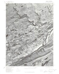
1976 Map of Bushkill
USGS Topo · Published 1978About this map
The Delaware River forms a prominent boundary in this mid-1970s orthophotoquad, where the water's edge meets the forested terrain of Monroe County. This aerial survey, produced by the Geological Survey and Soil Conservation Service, documents the landscape before more modern residential expansion altered the rural character of the area. The winding path of Bush Kill cuts through the northern portion of the map, leading toward the settlement of Bushkill. Near the river, the small community of Shoemakers sits along the road network that parallels the water. To the southeast, the massive footprint of the Yards Creek Reservoir stands out against the surrounding ridges. The imagery reveals a moment when the natural river valley still dominated the visual space, showing the interplay between the water, steep topography, and the sparse development of the late twentieth century.
Find a feature on this map
5 named features on this map. Tap any name to fly to it.
Don’t see what you’re looking for? This feature index may not catch every label — zoom into the map to look around manually.
Map Details
Editions of this 1976 Bushkill Map
This is the sole edition of this map. No revisions or reprints were ever made.
Other maps of this area

1888 · Hackettstown
USGS Topo · 1:62,500

1891 · Wallpack
USGS Topo · 1:62,500

1891 · Delaware Water Gap
USGS Topo · 1:62,500

1893 · Delaware Water Gap
USGS Topo · 1:62,500

1893 · Wallpack
USGS Topo · 1:62,500

1894 · Hackettstown
USGS Topo · 1:62,500

1898 · Hackettstown
USGS Topo · 1:62,500

1900 · Raritan
USGS Topo · 1:125,000

1905 · Raritan
USGS Topo · 1:125,000

1905 · Hackettstown
USGS Topo · 1:62,500
Featured Places
- Blairstown, NJ
- Hardwick Township, NJ
- Lehman Township, PA
- Saw Creek, Lehman Township
- Middle Smithfield Township, PA