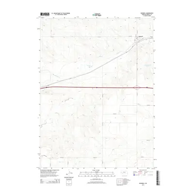
2014 Map of Bushnell
USGS Topo · Published 2014About this map
Bushnell stands as the primary settlement on this Kimball County plateau, situated along the historic path of the Lincoln Highway, here identified as Us-30. The village layout is clearly defined by residential streets such as Maple St and Birch St, with the Bushnell Cem located just to the northeast. The landscape is defined by the winding course of Lodgepole Cr, which meanders eastward toward the James Reservoir Number 2.
Find a feature on this map
22 named features on this map. Tap any name to fly to it.
Don’t see what you’re looking for? This feature index may not catch every label — zoom into the map to look around manually.
Map Details
Editions of this 2014 Bushnell Map
This is the sole edition of this map. No revisions or reprints were ever made.
Other maps of this area

1954 · Scottsbluff
USGS Topo · 1:250,000

1954 · Cheyenne
USGS Topo · 1:250,000

1958 · Cheyenne
USGS Topo · 1:250,000

1958 · Scottsbluff
USGS Topo · 1:250,000

1963 · Pine Bluffs
USGS Topo · 1:24,000

1963 · Lindbergh
USGS Topo · 1:24,000

1963 · Pine Bluffs SE
USGS Topo · 1:24,000

1968 · Pine Bluffs
USGS Topo · 1:24,000
1972 · Bushnell SW
USGS Topo · 1:24,000

1972 · Bushnell
USGS Topo · 1:24,000