
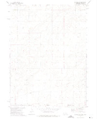
1972 Map of Bushnell
USGS Topo · Published 1975About this map
Bushnell sits at the heart of this Kimball County landscape, positioned along the vital transportation corridor defined by the Union Pacific railroad and Lodgepole Creek. The town's layout and surrounding infrastructure reflect the industrial and agricultural needs of the early 1970s, including Sewage Disp Ponds and a network of oil extraction sites. The presence of Malm to the southwest and several Oil Wells scattered across the high plains underscores the area's reliance on both rail transit and petroleum resources during this era.
Find a feature on this map
10 named features on this map. Tap any name to fly to it.
Don’t see what you’re looking for? This feature index may not catch every label — zoom into the map to look around manually.
Map Details
Editions of this 1972 Bushnell Map
This is the sole edition of this map. No revisions or reprints were ever made.
Other maps of this area

1954 · Scottsbluff
USGS Topo · 1:250,000

1954 · Cheyenne
USGS Topo · 1:250,000

1958 · Cheyenne
USGS Topo · 1:250,000

1958 · Scottsbluff
USGS Topo · 1:250,000

1963 · Pine Bluffs
USGS Topo · 1:24,000

1963 · Lindbergh
USGS Topo · 1:24,000

1963 · Pine Bluffs SE
USGS Topo · 1:24,000

1968 · Pine Bluffs
USGS Topo · 1:24,000
1972 · Bushnell SW
USGS Topo · 1:24,000

1972 · Bushnell SE
USGS Topo · 1:24,000