
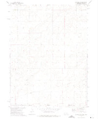
1972 Map of Bushnell SE
USGS Topo · Published 1975About this map
School No 22 stands as a lone educational landmark in the high plains of the Nebraska Colorado borderlands. This early 1970s landscape is defined by the industrial expansion of the Oil Field, with numerous Oil Wells scattered across the township sections north of the Kimball Co Weld Co line. The terrain is relatively open, marked primarily by the infrastructure of energy extraction, including a prominent Pipeline that traverses the southern half of the quadrangle. The map captures a specific moment when rural agricultural heritage, represented by the numbered country schoolhouse, intersected with the growing energy footprint in the panhandle region.
Find a feature on this map
6 named features on this map. Tap any name to fly to it.
Don’t see what you’re looking for? This feature index may not catch every label — zoom into the map to look around manually.
Map Details
Editions of this 1972 Bushnell SE Map
This is the sole edition of this map. No revisions or reprints were ever made.
Other maps of this area

1954 · Sterling
USGS Topo · 1:250,000

1954 · Scottsbluff
USGS Topo · 1:250,000

1958 · Scottsbluff
USGS Topo · 1:250,000

1958 · Sterling
USGS Topo · 1:250,000
1972 · Bushnell SW
USGS Topo · 1:24,000

1972 · Kimball SW
USGS Topo · 1:24,000

1972 · Bushnell
USGS Topo · 1:24,000

1972 · Kimball
USGS Topo · 1:24,000

1972 · Oliver Reservoir
USGS Topo · 1:24,000
1977 · Vim School
USGS Topo · 1:24,000