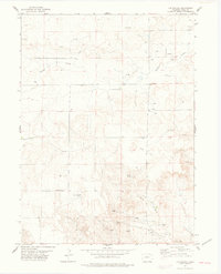
1977 Map of Vim School
USGS Topo · Published 1978About this map
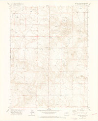
Vim School and Rockaway School anchor this corner of the eastern Colorado plains during the late 1970s. The landscape is defined by the ephemeral drainage patterns of Sidney Draw and the winding course of Twomile Creek, which reflect the reliance on scarce water resources in this arid Weld County region. Evidence of the local economy is scattered throughout the township lines, from the industrial presence of Oil Wells and a Gravel Pit to the agricultural necessity of numerous Wells and a Flowing Well. Notable localized landmarks include the Patton Spring and a pair of Landing Strips, likely serving local ranchers or crop dusters. A solitary Grave located north of the school serves as a quiet reminder of early settlement history in this high-plains environment.
Find a feature on this map
19 named features on this map. Tap any name to fly to it.
Don’t see what you’re looking for? This feature index may not catch every label — zoom into the map to look around manually.
Map Details
Editions of this 1977 Vim School Map
This is the sole edition of this map. No revisions or reprints were ever made.
Other maps of this area

1954 · Sterling
USGS Topo · 1:250,000

1954 · Scottsbluff
USGS Topo · 1:250,000

1958 · Scottsbluff
USGS Topo · 1:250,000

1958 · Sterling
USGS Topo · 1:250,000
1972 · Bushnell SW
USGS Topo · 1:24,000

1972 · Kimball SW
USGS Topo · 1:24,000

1972 · Bushnell SE
USGS Topo · 1:24,000
1977 · Pawnee Buttes
USGS Topo · 1:24,000
1977 · Gatehook Spring
USGS Topo · 1:24,000
1977 · Battle Canyon
USGS Topo · 1:24,000