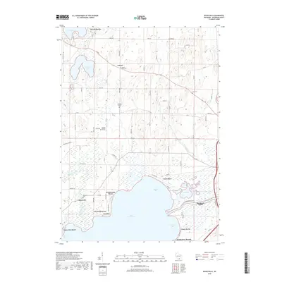
2018 Map of Busseyville
USGS Topo · Published 2018About this map
Lake Koshkonong dominates the southern reaches of this Jefferson County landscape, where the Rock River flows through a complex network of bays and wetlands. The area around Busseyville and Carcajou is marked by significant cultural landmarks, including the Koshkonong Mounds and Sylvan Mounds, indicating a long history of human presence near the shoreline. This 2018 survey reveals a pattern of modern lakeside development in communities like Vinnie Ha Ha, North Shore, and Blackhawk Island, contrasted with the interior's agricultural character. Genealogists will find a high concentration of burial sites throughout the township, including Oakland Center Cem, Oakland Evergreen Cem, and the Oakland Seventh-Day Cem, which reflect the diverse early denominational history of the Oakland vicinity.
Find a feature on this map
70 named features on this map. Tap any name to fly to it.
Don’t see what you’re looking for? This feature index may not catch every label — zoom into the map to look around manually.
Map Details
Editions of this 2018 Busseyville Map
This is the sole edition of this map. No revisions or reprints were ever made.
Other maps of this area

1890 · Sun Prairie
USGS Topo · 1:62,500

1890 · Stoughton
USGS Topo · 1:62,500

1891 · Waterloo
USGS Topo · 1:62,500

1891 · Koshkonong
USGS Topo · 1:62,500

1894 · Waterloo
USGS Topo · 1:62,500

1894 · Koshkonong
USGS Topo · 1:62,500

1896 · Sun Prairie
USGS Topo · 1:62,500

1905 · Sun Prairie
USGS Topo · 1:62,500

1906 · Koshkonong
USGS Topo · 1:62,500

1907 · Sun Prairie
USGS Topo · 1:62,500