
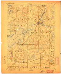
1894 Map of Koshkonong
USGS Topo · Published 1894About this map
Lake Koshkonong dominates this southern Wisconsin landscape, serving as a central hub for the surrounding townships of Sumner, Koshkonong, and Milton. The 1894 topography reveals a region defined by its glacial heritage, with numerous drumlins and wetland marshes surrounding the Rock River and Bark River systems. Fort Atkinson appears as a significant rail and water junction, where the Chicago and North Western Railroad bridges the river.
Find a feature on this map
27 named features on this map. Tap any name to fly to it.
Don’t see what you’re looking for? This feature index may not catch every label — zoom into the map to look around manually.
Map Details
Editions of this 1894 Koshkonong Map
2 editions found
Other maps of this area

1890 · Sun Prairie
USGS Topo · 1:62,500

1890 · Stoughton
USGS Topo · 1:62,500

1891 · Waterloo
USGS Topo · 1:62,500

1891 · Koshkonong
USGS Topo · 1:62,500

1891 · Janesville
USGS Topo · 1:62,500

1892 · Watertown
USGS Topo · 1:62,500

1892 · Whitewater
USGS Topo · 1:62,500

1893 · Delavan
USGS Topo · 1:62,500

1893 · Whitewater
USGS Topo · 1:62,500

1893 · Janesville
USGS Topo · 1:62,500