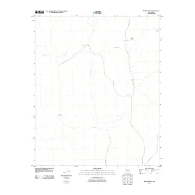
2010 Map of Bustos Well
USGS Topo · Published 2010About this map
Bustos Tank and the surrounding drainage network define this arid reach of Socorro County during the first decade of the 21st century. The landscape is characterized by its vital water management features, including the Jornada Detention Dam and livestock watering points like Crespin Tank and New Tank. These features are essential for land use in an environment dominated by ephemeral watercourses such as Arroyo Tinajas, Arroyo de la Cañas, and Arroyo de las Cañas. The terrain rises toward the feature known as La Montonera, while a series of designated service routes, such as WSMR S Route 3613 and WSMR P Route 5, navigate the drainage-heavy topography. The map illustrates a modern layer of infrastructure laid over a traditional ranching and desert landscape, showing how access and water retention are managed in this part of New Mexico.
Find a feature on this map
12 named features on this map. Tap any name to fly to it.
Don’t see what you’re looking for? This feature index may not catch every label — zoom into the map to look around manually.
Map Details
Editions of this 2010 Bustos Well Map
This is the sole edition of this map. No revisions or reprints were ever made.
Other maps of this area

1906 · Socorro
USGS Topo · 1:62,500

1916 · La Joya
USGS Topo · 1:125,000

1948 · Carthage
USGS Topo · 1:62,500

1948 · San Antonio
USGS Topo · 1:62,500

1954 · Tularosa
USGS Topo · 1:250,000

1954 · Socorro
USGS Topo · 1:250,000

1958 · Socorro
USGS Topo · 1:250,000

1958 · Tularosa
USGS Topo · 1:250,000

1959 · Loma De Las Canas
USGS Topo · 1:24,000

1959 · Mesa Del Yeso
USGS Topo · 1:24,000