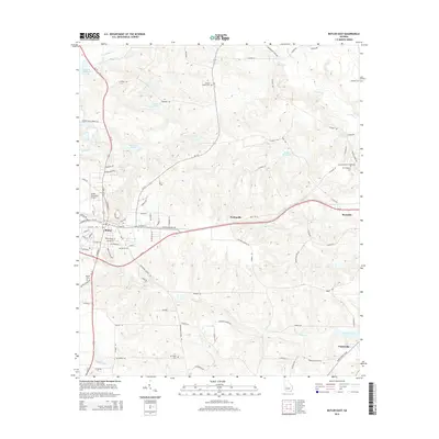
2014 Map of Butler East
USGS Topo · Published 2014About this map
Butler serves as the focal point for this Taylor County landscape, situated where Us-19 and Ga-137 intersect. The area is defined by a series of creeks including Patsiliga Cr and Beaver Cr that feed into several industrial millponds, such as McCants Millpond and Suggs Millpond. These water features suggest a long history of water-powered industry in the region.
Find a feature on this map
109 named features on this map. Tap any name to fly to it.
Don’t see what you’re looking for? This feature index may not catch every label — zoom into the map to look around manually.
Map Details
Editions of this 2014 Butler East Map
This is the sole edition of this map. No revisions or reprints were ever made.
Other maps of this area

1955 · Phenix City
USGS Topo · 1:250,000

1957 · Phenix City
USGS Topo · 1:250,000

1958 · Phenix City
USGS Topo · 1:250,000

1971 · Rupert
USGS Topo · 1:24,000

1971 · Prattsburg
USGS Topo · 1:24,000

1971 · Fickling Mill
USGS Topo · 1:24,000

1971 · Reynolds
USGS Topo · 1:24,000
1971 · Roberta
USGS Topo · 1:24,000

1971 · Ideal North
USGS Topo · 1:24,000

1971 · Garden Valley
USGS Topo · 1:24,000