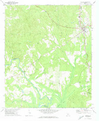
1971 Map of Roberta
USGS Topo · Published 1974About this map
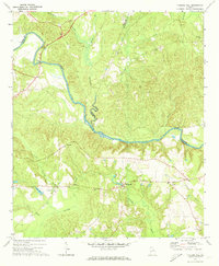
The Southern railway corridor defines the eastern boundary of this central Georgia landscape, anchoring the town of Roberta as a local hub of transportation and commerce. Moving west, the terrain transitions into a dense network of watercourses and family-named landmarks. The Flint River snakes through the southwest corner, forming the border between Crawford and Taylor counties. This waterway is fed by numerous tributaries such as Boggy Branch, Beech Creek, and Beaver Swamp. The distribution of rural landmarks suggests a long-established community, with several significant sites such as Walker Chapel, Bethel Ch, and the Radford Grave located deep within the wooded hills. Outside of the main town, smaller settlements like Gaillard and Hammett appear alongside industrial sites including a Claypit and several Sandpits, reflecting the local extractive economy of the early 1970s.
Find a feature on this map
35 named features on this map. Tap any name to fly to it.
Don’t see what you’re looking for? This feature index may not catch every label — zoom into the map to look around manually.
Map Details
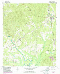
Editions of this 1971 Roberta Map
2 editions found
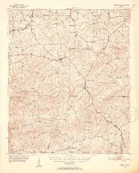
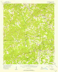
Other maps of this area
1951 · Yatesville
USGS Topo · 1:62,500

1955 · Phenix City
USGS Topo · 1:250,000

1956 · Fort Valley
USGS Topo · 1:62,500
1956 · Bolingbroke
USGS Topo · 1:62,500

1957 · Phenix City
USGS Topo · 1:250,000

1957 · Macon
USGS Topo · 1:250,000

1958 · Macon
USGS Topo · 1:250,000

1958 · Phenix City
USGS Topo · 1:250,000

1964 · Macon
USGS Topo · 1:250,000
1971 · Fickling Mill
USGS Topo · 1:24,000