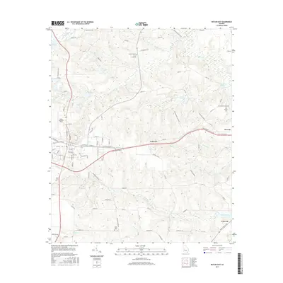
2017 Map of Butler East
USGS Topo · Published 2017About this map
Panhandle sits at the center of this Georgia landscape, situated between the expanding western reaches of Reynolds and the city of Butler. The terrain is defined by a dense network of watercourses, including Patsiliga Creek and Horse Creek, which feed into numerous historic millponds. These water features, such as Minors Millpond, Suggs Millpond, and McCants Millpond, suggest a legacy of local industry tied to the region's hydrology.
Find a feature on this map
105 named features on this map. Tap any name to fly to it.
Don’t see what you’re looking for? This feature index may not catch every label — zoom into the map to look around manually.
Map Details
Editions of this 2017 Butler East Map
This is the sole edition of this map. No revisions or reprints were ever made.
Other maps of this area

1955 · Phenix City
USGS Topo · 1:250,000

1957 · Phenix City
USGS Topo · 1:250,000

1958 · Phenix City
USGS Topo · 1:250,000

1971 · Rupert
USGS Topo · 1:24,000

1971 · Prattsburg
USGS Topo · 1:24,000

1971 · Fickling Mill
USGS Topo · 1:24,000

1971 · Reynolds
USGS Topo · 1:24,000
1971 · Roberta
USGS Topo · 1:24,000

1971 · Ideal North
USGS Topo · 1:24,000

1971 · Garden Valley
USGS Topo · 1:24,000