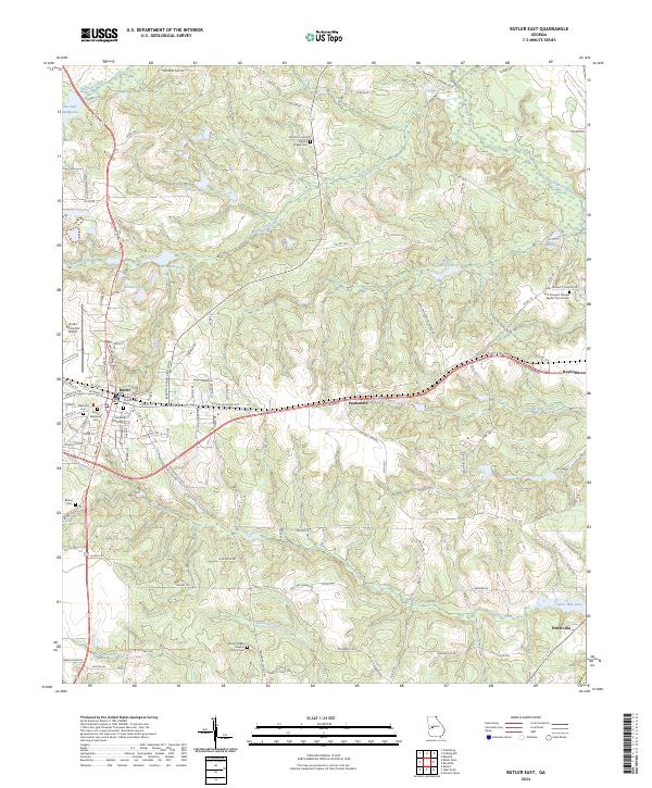
2024 Map of Butler East
USGS Topo · Published 2024About this map
Butler serves as the primary hub of this landscape, where the E Fall Line Freeway intersects local routes in Taylor County. The surrounding area is defined by a series of significant water bodies and historical landmarks, including McCants Millpond and Minors Millpond, reflecting a history of local industry and water management. Smaller settlements like Potterville and Panhandle are situated among a network of creeks, such as Patsiliga Creek and Horse Creek. Genealogy researchers will find several well-documented burial sites across the terrain, including Butler Memorial Cem and the Mount Pisgah Baptist Church Cem. The topography is shaped by various tributaries, including Toteover Creek and Little Vine Creek, which flow through the rolling landscape between the town center and Taylor Mill Lake.
Find a feature on this map
112 named features on this map. Tap any name to fly to it.
Don’t see what you’re looking for? This feature index may not catch every label — zoom into the map to look around manually.
Map Details
Editions of this 2024 Butler East Map
This is the sole edition of this map. No revisions or reprints were ever made.
Other maps of this area

1955 · Phenix City
USGS Topo · 1:250,000

1957 · Phenix City
USGS Topo · 1:250,000

1958 · Phenix City
USGS Topo · 1:250,000

1971 · Rupert
USGS Topo · 1:24,000

1971 · Prattsburg
USGS Topo · 1:24,000

1971 · Fickling Mill
USGS Topo · 1:24,000

1971 · Reynolds
USGS Topo · 1:24,000
1971 · Roberta
USGS Topo · 1:24,000

1971 · Ideal North
USGS Topo · 1:24,000

1971 · Garden Valley
USGS Topo · 1:24,000