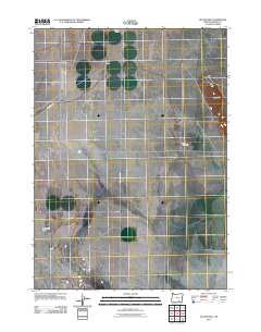
2011 Map of Butler Hill
USGS Topo · Published 2011About this map
Koontz Homestead and Rieckens Corner mark the persistent presence of ranching and early settlement in the high desert of Harney County. This 2011 survey illustrates a sparse human landscape defined by vast distances, where small named localities like Catlow and Beckley serve as critical reference points along the straight stretches of Catlow Valley Rd. The topography is dominated by the solitary rise of Butler Hill to the east, while the drainage of the basin is traced by the seasonal hydrology of Rock Creek Sinks. The map highlights the intersection of historic land claims and modern infrastructure, showing how early 20th-century family names remain anchored to the land via specialized road networks like Rock Creek Rd.
Find a feature on this map
8 named features on this map. Tap any name to fly to it.
Don’t see what you’re looking for? This feature index may not catch every label — zoom into the map to look around manually.
Map Details
Editions of this 2011 Butler Hill Map
This is the sole edition of this map. No revisions or reprints were ever made.
Other maps of this area

1955 · Adel
USGS Topo · 1:250,000

1957 · Adel
USGS Topo · 1:250,000

1958 · Adel
USGS Topo · 1:250,000

1962 · Adel
USGS Topo · 1:250,000

1967 · Roaring Springs
USGS Topo · 1:24,000

1967 · Frenchglen
USGS Topo · 1:24,000

1971 · Duhaime Flat East
USGS Topo · 1:24,000

1971 · Blitzen
USGS Topo · 1:24,000

1971 · Butler Hill
USGS Topo · 1:24,000
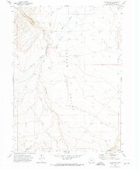
1971 · Blitzen SW
USGS Topo · 1:24,000