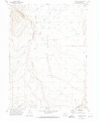
1971 Map of Blitzen SW
USGS Topo · Published 1974About this map
Catlow Valley dominates this 1970s landscape, revealing the stark topography of a Great Basin interior drainage system. The map documents the intricate path of Guano Slough as it winds through the basin floor, a feature that highlights the intermittent water patterns characteristic of the high desert. The survey captures the region prior to significant modern land-use changes, preserving the original township and range delineations like T. 34 S. and T. 35 S. which were foundational to the settlement and grazing history of Harney County. The precise five-foot contour intervals detail the subtle shifts in elevation across the depression, providing a clear record of the area's natural drainage before contemporary environmental shifts.
Find a feature on this map
5 named features on this map. Tap any name to fly to it.
Don’t see what you’re looking for? This feature index may not catch every label — zoom into the map to look around manually.
Map Details
Editions of this 1971 Blitzen SW Map
This is the sole edition of this map. No revisions or reprints were ever made.
Other maps of this area

1955 · Adel
USGS Topo · 1:250,000

1957 · Adel
USGS Topo · 1:250,000

1958 · Adel
USGS Topo · 1:250,000

1962 · Adel
USGS Topo · 1:250,000

1971 · Fish Fin Rim
USGS Topo · 1:24,000

1971 · Beatys Butte
USGS Topo · 1:24,000

1971 · Blitzen
USGS Topo · 1:24,000

1971 · Butler Hill
USGS Topo · 1:24,000
1971 · Guano Reservoir
USGS Topo · 1:24,000
1971 · Coyote Gap
USGS Topo · 1:24,000