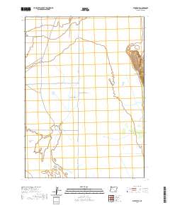
2020 Map of Butler Hill
USGS Topo · Published 2020About this map
Catlow Valley dominates this high desert landscape in Harney County, defined by its characteristic basin drainage and stark geological boundaries. The eastern edge of the quadrangle is marked by the prominent Catlow Rim, which rises sharply to the summit of Butler Hill, a significant vertical landmark in an otherwise broad, alluvial expanse. This 2020 survey illustrates the sparse but critical transportation network essential to this arid region, where Catlow Valley Rd and Blitten Valley Rd intersect to connect the remote basin floor. Hydrological patterns are particularly distinct here, with the Rock Creek Sinks serving as a primary drainage point for seasonal runoff in a landscape where water is the primary architect of the terrain.
Find a feature on this map
12 named features on this map. Tap any name to fly to it.
Don’t see what you’re looking for? This feature index may not catch every label — zoom into the map to look around manually.
Map Details
Editions of this 2020 Butler Hill Map
This is the sole edition of this map. No revisions or reprints were ever made.
Other maps of this area

1955 · Adel
USGS Topo · 1:250,000

1957 · Adel
USGS Topo · 1:250,000

1958 · Adel
USGS Topo · 1:250,000

1962 · Adel
USGS Topo · 1:250,000

1967 · Roaring Springs
USGS Topo · 1:24,000

1967 · Frenchglen
USGS Topo · 1:24,000

1971 · Duhaime Flat East
USGS Topo · 1:24,000

1971 · Blitzen
USGS Topo · 1:24,000

1971 · Butler Hill
USGS Topo · 1:24,000
1971 · Blitzen SW
USGS Topo · 1:24,000