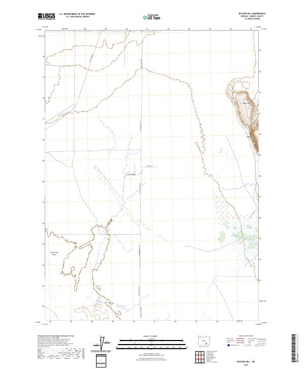
2023 Map of Butler Hill
USGS Topo · Published 2023About this map
Catlow Valley and the prominent rising face of Catlow Rim define this portion of the high desert in Harney County. The landscape is marked by unique hydrological features such as the Rock Creek Sinks, where surface water disappears into the basin's floor. Human presence is etched onto this expanse through a network of isolated rural routes, including Rock Creek Ln and Catlow Valley Rd, which facilitate movement through the vast township sections of t33s r31e and t34s r31e. In the northeastern corner, Butler Hill stands as a distinct topographical landmark overlooking the basin. This survey provides a precise look at the modern drainage patterns and road infrastructure that sustain this remote interior region of Oregon.
Find a feature on this map
13 named features on this map. Tap any name to fly to it.
Don’t see what you’re looking for? This feature index may not catch every label — zoom into the map to look around manually.
Map Details
Editions of this 2023 Butler Hill Map
This is the sole edition of this map. No revisions or reprints were ever made.
Other maps of this area

1955 · Adel
USGS Topo · 1:250,000

1957 · Adel
USGS Topo · 1:250,000

1958 · Adel
USGS Topo · 1:250,000

1962 · Adel
USGS Topo · 1:250,000

1967 · Roaring Springs
USGS Topo · 1:24,000

1967 · Frenchglen
USGS Topo · 1:24,000

1971 · Duhaime Flat East
USGS Topo · 1:24,000

1971 · Blitzen
USGS Topo · 1:24,000

1971 · Butler Hill
USGS Topo · 1:24,000
1971 · Blitzen SW
USGS Topo · 1:24,000