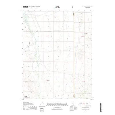
2018 Map of Butler Mountain
USGS Topo · Published 2018About this map
The East Walker River meanders through a desert valley, defining the western landscape of this 2018 survey. This riparian corridor provides a stark contrast to the high, arid peaks of the Wassuk Range and the central prominence of Butler Mtn. Human activity is primarily limited to rugged ranch roads and access routes, such as the Rafter 7 Cutoff and E Walker Rd, which traverse the open range.
Find a feature on this map
14 named features on this map. Tap any name to fly to it.
Don’t see what you’re looking for? This feature index may not catch every label — zoom into the map to look around manually.
Map Details
Editions of this 2018 Butler Mountain Map
This is the sole edition of this map. No revisions or reprints were ever made.
Other maps of this area

1891 · Wellington
USGS Topo · 1:125,000

1893 · Wellington
USGS Topo · 1:125,000

1909 · Hawthorne
USGS Topo · 1:250,000

1911 · Hawthorne
USGS Topo · 1:250,000

1915 · Hawthorne
USGS Topo · 1:250,000

1948 · Walker Lake
USGS Topo · 1:250,000

1956 · Mt. Grant
USGS Topo · 1:62,500

1957 · Walker Lake
USGS Topo · 1:250,000

1957 · Yerington
USGS Topo · 1:62,500

1958 · Pine Grove Hills
USGS Topo · 1:62,500