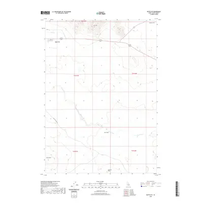
2020 Map of Butte City
USGS Topo · Published 2020About this map
Butte City anchors this portion of Butte County, Idaho, where the desert floor meets the base of the Arco Hills. The landscape is defined by the winding course of the Big Lost River, which cuts through the southern reaches of the quadrangle and passes through the distinctive Box Canyon. Human efforts to manage the arid environment are visible in the Arco Canal and the local grid of Butte City south of Birch St. The surrounding terrain is punctuated by volcanic and geological markers, including Sixmile Butte in the southwest and Teakettle Butte to the southeast. North of the city, the land levels out into Deadman Flat, while the Arco-Service Berry Rd provides a primary transit link through the sagebrush-dominated flats of the Snake River Plain.
Find a feature on this map
15 named features on this map. Tap any name to fly to it.
Don’t see what you’re looking for? This feature index may not catch every label — zoom into the map to look around manually.
Map Details
Editions of this 2020 Butte City Map
This is the sole edition of this map. No revisions or reprints were ever made.
Other maps of this area

1955 · Idaho Falls
USGS Topo · 1:250,000

1958 · Idaho Falls
USGS Topo · 1:250,000

1972 · Quaking Aspen Butte
USGS Topo · 1:24,000

1972 · Arco North
USGS Topo · 1:24,000

1972 · Arco Hills SE
USGS Topo · 1:24,000

1972 · Big Southern Butte
USGS Topo · 1:24,000

1972 · Arco South
USGS Topo · 1:24,000

1972 · Howe Peak
USGS Topo · 1:24,000

1972 · Butte City
USGS Topo · 1:24,000

1972 · Arco Hills
USGS Topo · 1:24,000