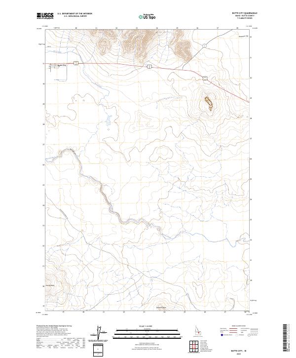
2023 Map of Butte City
USGS Topo · Published 2023About this map
Butte City serves as the primary human settlement in this high-desert landscape of eastern Idaho, situated along a stretch of modern roadway and the historical corridor of the Arco Canal. The surrounding terrain is defined by dramatic volcanic and alluvial features, including the Arco Hills and isolated landforms like Sixmile Butte and Teakettle Butte. The Big Lost River meanders through the central portion of the quadrangle, cutting into the landscape at Box Canyon and flowing toward the expansive Deadman Flat to the northeast. This 2023 survey illustrates the complex relationship between water management and the arid environment, where man-made infrastructure like the Arco Canal follows the natural contours of the basin to support the remote communities of Butte County. Local transportation is anchored by Arco-Service Berry Rd and Birch St, providing access to the rugged interiors of the Lost River desert.
Find a feature on this map
15 named features on this map. Tap any name to fly to it.
Don’t see what you’re looking for? This feature index may not catch every label — zoom into the map to look around manually.
Map Details
Editions of this 2023 Butte City Map
This is the sole edition of this map. No revisions or reprints were ever made.
Other maps of this area

1955 · Idaho Falls
USGS Topo · 1:250,000

1958 · Idaho Falls
USGS Topo · 1:250,000

1972 · Quaking Aspen Butte
USGS Topo · 1:24,000

1972 · Arco North
USGS Topo · 1:24,000

1972 · Arco Hills SE
USGS Topo · 1:24,000

1972 · Big Southern Butte
USGS Topo · 1:24,000

1972 · Arco South
USGS Topo · 1:24,000

1972 · Howe Peak
USGS Topo · 1:24,000

1972 · Butte City
USGS Topo · 1:24,000

1972 · Arco Hills
USGS Topo · 1:24,000