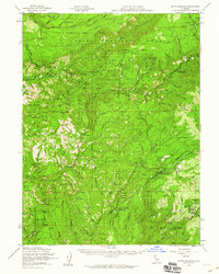
1958 Map of Butte Meadows
USGS Topo · Published 1960About this map
Butte Meadows serves as a central hub for this high-country survey of the northern Sierras, situated where the Tehama Co Butte Co line crosses the Humboldt Road. The landscape is defined by the headwaters of major drainages including the West Branch Feather River and Deer Creek, which features a Fish Ladder near Potato Patch Campground. The map documents a network of forestry and pioneer infrastructure, from the Colby Mtn Lookout to remote outposts like Savercool Place and Lost Camp.
Find a feature on this map
66 named features on this map. Tap any name to fly to it.
Don’t see what you’re looking for? This feature index may not catch every label — zoom into the map to look around manually.
Map Details
Editions of this 1958 Butte Meadows Map
3 editions found
Other maps of this area

1886 · Lassen Peak
USGS Topo · 1:250,000

1888 · Bidwell Bar
USGS Topo · 1:125,000

1891 · Bidwell Bar
USGS Topo · 1:125,000

1891 · Chico
USGS Topo · 1:125,000

1892 · Lassen Peak
USGS Topo · 1:250,000

1893 · Chico
USGS Topo · 1:125,000

1893 · Bidwell Bar
USGS Topo · 1:125,000

1894 · Lassen Peak
USGS Topo · 1:250,000

1895 · Bidwell Bar
USGS Topo · 1:125,000

1895 · Chico
USGS Topo · 1:125,000