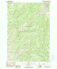
1990 Map of Butterfield Gulch
USGS Topo · Published 1990About this map
Payette National Forest dominates this landscape in Adams County, where high-elevation drainage systems and scattered resource extraction sites define the terrain. Evidence of early mountain industry is visible near Placer Basin, where a Mine and Shaft are recorded along Placer Cr. The map reveals a network of primitive transportation, marked by Pack trails and 4wd tracks that connect remote water sources like Cold Creek Spring and Little Bear Spring.
Find a feature on this map
33 named features on this map. Tap any name to fly to it.
Don’t see what you’re looking for? This feature index may not catch every label — zoom into the map to look around manually.
Map Details
Editions of this 1990 Butterfield Gulch Map
This is the sole edition of this map. No revisions or reprints were ever made.
Other maps of this area

1911 · Meadows
USGS Topo · 1:125,000

1920 · Seven Devils Mining District
USGS Topo · 1:48,000

1938 · Riggins
USGS Topo · 1:96,000

1945 · Riggins
USGS Topo · 1:125,000

1954 · New Meadows
USGS Topo · 1:62,500

1955 · Baker
USGS Topo · 1:250,000

1955 · Grangeville
USGS Topo · 1:250,000

1957 · Cuprum
USGS Topo · 1:62,500

1957 · Hornet
USGS Topo · 1:62,500

1959 · Baker
USGS Topo · 1:250,000