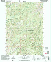
2004 Map of Butterfield Gulch
USGS Topo · Published 2007About this map
The Payette National Forest landscape recorded in this 2004 revision reveals a high-elevation backcountry shaped by early 20th-century resource extraction and conservation. Evidence of the area's mining history is preserved at Placer Basin, where labels for a Mine and Shaft indicate legacy workings near the northern boundary. The presence of the Barrinaga Corrals (Site) provides a specific reference point for local researchers interested in the region's historic ranching and livestock movement patterns through the gulches.
Find a feature on this map
33 named features on this map. Tap any name to fly to it.
Don’t see what you’re looking for? This feature index may not catch every label — zoom into the map to look around manually.
Map Details
Editions of this 2004 Butterfield Gulch Map
This is the sole edition of this map. No revisions or reprints were ever made.
Other maps of this area

1911 · Meadows
USGS Topo · 1:125,000

1920 · Seven Devils Mining District
USGS Topo · 1:48,000

1938 · Riggins
USGS Topo · 1:96,000

1945 · Riggins
USGS Topo · 1:125,000

1954 · New Meadows
USGS Topo · 1:62,500

1955 · Baker
USGS Topo · 1:250,000

1955 · Grangeville
USGS Topo · 1:250,000

1957 · Cuprum
USGS Topo · 1:62,500

1957 · Hornet
USGS Topo · 1:62,500

1959 · Baker
USGS Topo · 1:250,000