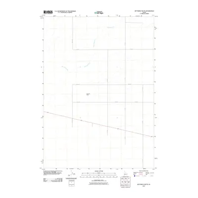
2010 Map of Butterfly Butte
USGS Topo · Published 2010About this map
Butterfly Butte rises as a primary landmark in this section of Bonneville County, where the landscape is defined by the stark intersection of natural landforms and the rigid geometry of the Public Land Survey System. The area is marked by a network of drainage and irrigation, most notably the Kettle Butte Drain which cuts across the terrain. This 2010 survey illustrates a sparsely populated agricultural or rangeland environment, organized by a strictly partitioned road network including 155th Rd W and W 113 N. The drainage patterns suggest a high degree of land management for water control in an arid Idaho climate, providing a clear record of the infrastructure supporting the region's rural character at the start of the 21st century.
Find a feature on this map
10 named features on this map. Tap any name to fly to it.
Don’t see what you’re looking for? This feature index may not catch every label — zoom into the map to look around manually.
Map Details
Editions of this 2010 Butterfly Butte Map
This is the sole edition of this map. No revisions or reprints were ever made.
Other maps of this area

1948 · Woodville
USGS Topo · 1:24,000

1949 · Roberts
USGS Topo · 1:62,500

1949 · Roberts
USGS Topo · 1:24,000

1949 · Shattuck Butte
USGS Topo · 1:24,000

1950 · Shattuck Butte
USGS Topo · 1:24,000

1950 · Woodville
USGS Topo · 1:24,000

1950 · Roberts
USGS Topo · 1:24,000

1955 · Idaho Falls
USGS Topo · 1:250,000

1958 · Idaho Falls
USGS Topo · 1:250,000
1959 · Woodville
USGS Topo · 1:24,000