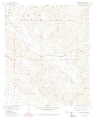
1981 Map of Butterfly Peak
USGS Topo · Published 1988About this map
The San Jacinto Mountains dominate this landscape, showcasing a high-altitude wilderness managed by the San Bernardino National Forest and including a portion of the Santa Rosa Indian Reservation. Miners and prospectors were active along the upper slopes of Thomas Mountain and Gold Hill, leaving behind traces such as the New Hemet Bell Mine and the Gold Shot Mine. The Pacific Crest National Scenic Trail traverses the rugged ridges, connecting high points like Butterfly Peak and Lookout Mountain with the more level terrain of Vandeventer Flat.
Find a feature on this map
44 named features on this map. Tap any name to fly to it.
Don’t see what you’re looking for? This feature index may not catch every label — zoom into the map to look around manually.
Map Details
Editions of this 1981 Butterfly Peak Map
4 editions found
Other maps of this area

1901 · Southern California Sheet No. 1
USGS Topo · 1:250,000

1901 · San Jacinto
USGS Topo · 1:125,000

1903 · Ramona
USGS Topo · 1:125,000

1904 · Indio
USGS Topo · 1:125,000

1904 · Southern California Sheet No. 2
USGS Topo · 1:250,000

1904 · Southern California Sheet No. 1
USGS Topo · 1:250,000

1931 · Vallecito
USGS Topo · 1:125,000

1939 · Warner Springs
USGS Topo · 1:62,500

1940 · Hemet Reservoir
USGS Topo · 1:62,500

1941 · Toro Peak
USGS Topo · 1:62,500