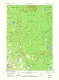
1968 Map of Butternut
USGS Topo · Published 1971About this map
Butternut sits in the southwestern corner of this Wisconsin survey, served by the Soo Line and Chippewa Line railroads and containing the local Union Cem. To the east, the landscape transitions into a complex water network where the Flambeau River meets several major rapids, including Stubbs Rapids and Quinns Rapids. The map details the rugged hydrologic character of the Ashland and Iron County border, marked by many gravel pits and smaller lakes like Cycle Lake and Augustine Lake.
Find a feature on this map
52 named features on this map. Tap any name to fly to it.
Don’t see what you’re looking for? This feature index may not catch every label — zoom into the map to look around manually.
Map Details
Editions of this 1968 Butternut Map
This is the sole edition of this map. No revisions or reprints were ever made.
Other maps of this area

1940 · Mercer
USGS Topo · 1:48,000

1940 · Butternut
USGS Topo · 1:48,000

1940 · Upson
USGS Topo · 1:48,000

1941 · Park Falls
USGS Topo · 1:48,000

1941 · Pike Lake
USGS Topo · 1:48,000

1941 · Kennedy
USGS Topo · 1:48,000

1942 · Pike Lake
USGS Topo · 1:48,000

1942 · Glidden
USGS Topo · 1:48,000

1942 · Mellen
USGS Topo · 1:48,000

1943 · Upson
USGS Topo · 1:48,000