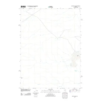
2012 Map of Button Lake
USGS Topo · Published 2012About this map
Button Lake and the drainage patterns of northern Nevada define this high-desert basin near the turn of the 21st century. The landscape is characterized by intermittent water sources and the low-relief geography typical of the Great Basin region. Further west, Evans Lake occupies a small depression, while the seasonal flow of Lake Creek winds through the southern portion of the quadrangle. This 2012 survey by the U.S. Geological Survey provides a precise record of the hydrologic features in an area where water is the primary determinant of land use and environmental character. The map offers researchers a clear view of the natural water distribution before modern climatic shifts or human interventions might alter these sensitive desert lakebeds.
Find a feature on this map
3 named features on this map. Tap any name to fly to it.
Don’t see what you’re looking for? This feature index may not catch every label — zoom into the map to look around manually.
Map Details
Editions of this 2012 Button Lake Map
This is the sole edition of this map. No revisions or reprints were ever made.
Other maps of this area

1882 · Paradise
USGS Topo · 1:250,000

1893 · Paradise
USGS Topo · 1:250,000

1955 · McDermitt
USGS Topo · 1:250,000

1959 · McDermitt
USGS Topo · 1:250,000

1973 · Star Valley Ridge SW
USGS Topo · 1:24,000

1973 · Button Lake Well
USGS Topo · 1:24,000

1973 · Humboldt Hill
USGS Topo · 1:24,000
1980 · Button Lake
USGS Topo · 1:24,000

1980 · Greeley Flat
USGS Topo · 1:24,000
1980 · Maiden Butte
USGS Topo · 1:24,000