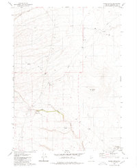
1980 Map of Maiden Butte
USGS Topo · Published 1980About this map
The Little Owyhee River cuts through this high desert terrain in Humboldt County, defining a landscape marked by essential water sources and rugged topography. In the late 1970s, when this area was field checked, remote outposts like Owyhee Camp and Maiden Springs served as critical points for those navigating the eastern Nevada range. The map illustrates a network of unimproved routes, labeled simply as Jeep Trail, which wind through the elevations near Raven and toward the prominent volcanic profile of Maiden Butte.
Find a feature on this map
14 named features on this map. Tap any name to fly to it.
Don’t see what you’re looking for? This feature index may not catch every label — zoom into the map to look around manually.
Map Details
Editions of this 1980 Maiden Butte Map
This is the sole edition of this map. No revisions or reprints were ever made.
Other maps of this area

1882 · Paradise
USGS Topo · 1:250,000

1893 · Paradise
USGS Topo · 1:250,000

1955 · McDermitt
USGS Topo · 1:250,000

1959 · McDermitt
USGS Topo · 1:250,000

1980 · Calico Butte
USGS Topo · 1:24,000

1980 · Capitol Peak
USGS Topo · 1:24,000

1980 · Mahogany Spring
USGS Topo · 1:24,000
1980 · Button Lake
USGS Topo · 1:24,000

1980 · Greeley Flat
USGS Topo · 1:24,000
1980 · Nadine Butte
USGS Topo · 1:24,000