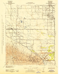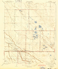
1932 Map of Buttonwillow
USGS Topo · Published 1943About this map
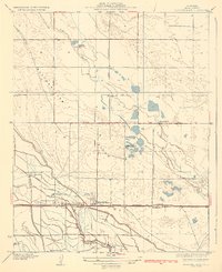
Miller and Lux Headquarters Ranch anchors this landscape, reflecting the massive landholding interests that shaped the southern San Joaquin Valley's agricultural development. The settlement of Buttonwillow sits at the heart of an intricate irrigation network including the East Side Canal, Garden Ditch, and Poplar Canal, which reclaimed the arid terrain for large-scale ranching. This 1920s survey also reveals a unique recreational layer to the region, with several sporting organizations like the Buttonwillow Gun Club and Redmen Gun Club located near the wetlands of Jerry Slough.
Find a feature on this map
30 named features on this map. Tap any name to fly to it.
Don’t see what you’re looking for? This feature index may not catch every label — zoom into the map to look around manually.
Map Details
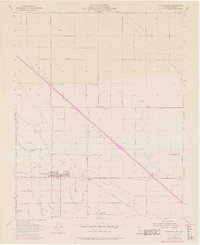
Editions of this 1932 Buttonwillow Map
3 editions found
Historical Maps of Buttonwillow Through Time
7 maps found