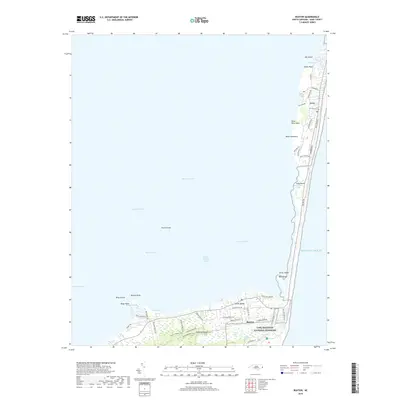
2019 Map of Buxton
USGS Topo · Published 2019About this map
Hatteras Island dominates this 2019 survey, illustrating the fragile geography of North Carolina’s Outer Banks between the Pamlico Sound and the Atlantic Ocean. The map centers on the sharp southward turn of the coastline at Buxton, where the maritime forest of the Cape Hatteras National Seashore provides a buffer against the sea. To the north, the settlement of Avon is shown with its dense residential grid along roads like Big Kinnakeet Dr and Ocean View Dr, illustrating the contemporary coastal development pattern.
Find a feature on this map
55 named features on this map. Tap any name to fly to it.
Don’t see what you’re looking for? This feature index may not catch every label — zoom into the map to look around manually.
Map Details
Editions of this 2019 Buxton Map
This is the sole edition of this map. No revisions or reprints were ever made.
Other maps of this area

1948 · Cape Hatteras
USGS Topo · 1:24,000

1948 · Buxton
USGS Topo · 1:24,000

1950 · Cape Hatteras
USGS Topo · 1:24,000

1950 · Buxton
USGS Topo · 1:24,000

1955 · Wanchese
USGS Topo · 1:250,000

1957 · Manteo
USGS Topo · 1:250,000

1960 · Manteo
USGS Topo · 1:250,000

1985 · Cape Hatteras
USGS Topo · 1:100,000

2002 · Cape Hatteras
USGS Topo · 1:24,000

2011 · Buxton
USGS Topo · 1:24,000