
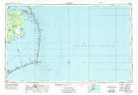
1957 Map of Manteo
USGS Topo · Published 1967About this map
The Outer Banks and the complex estuarine waters of the North Carolina coast are documented here during a period of significant preservation and coastal development. Roanoke Island serves as a central hub, featuring the Fort Raleigh National Historic Site and the settlements of Manteo and Wanchese. To the west, the Intracoastal Waterway cuts through Alligator River and Albemarle Sound, highlighting the region's reliance on maritime transport before modern highway expansions reached the further reaches of the peninsula.
Find a feature on this map
103 named features on this map. Tap any name to fly to it.
Don’t see what you’re looking for? This feature index may not catch every label — zoom into the map to look around manually.
Map Details
Editions of this 1957 Manteo Map
3 editions found
Other maps of this area

1940 · Kitty Hawk
USGS Topo · 1:62,500

1940 · Powells Point
USGS Topo · 1:62,500

1940 · Wade Point
USGS Topo · 1:62,500

1943 · Wade Point
USGS Topo · 1:62,500

1943 · Columbia
USGS Topo · 1:125,000

1943 · Roanoke Island
USGS Topo · 1:125,000

1946 · Eastville
USGS Topo · 1:250,000

1946 · Currituck Sound
USGS Topo · 1:250,000

1948 · Wade Point
USGS Topo · 1:62,500

1948 · Cape Hatteras
USGS Topo · 1:24,000