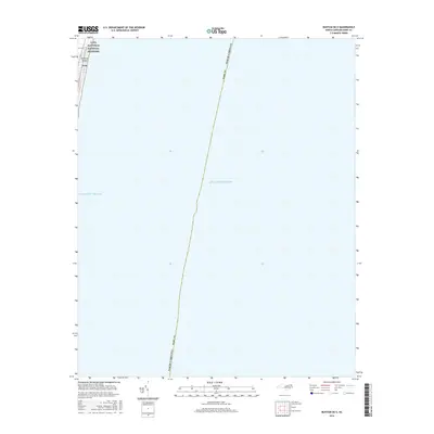
2016 Map of Buxton OE E
USGS Topo · Published 2016About this map
Hatteras Island occupies a slim sliver of the northwest corner of this maritime map, where the coastal community of Avon is situated along the shore. This 2016 survey emphasizes the vastness of the Atlantic Ocean and the critical protective boundaries of the Cape Hatteras National Seashore. The map illustrates the fragile geography of the Outer Banks, showing the narrow strip of land that separates the interior sounds from the open ocean. Detailed topographic data captures the low-lying nature of the barrier island, highlighting the intersection of human settlement and federal conservation land in a region defined by its exposure to the sea.
Find a feature on this map
5 named features on this map. Tap any name to fly to it.
Don’t see what you’re looking for? This feature index may not catch every label — zoom into the map to look around manually.
Map Details
Editions of this 2016 Buxton OE E Map
This is the sole edition of this map. No revisions or reprints were ever made.
Other maps of this area

1948 · Cape Hatteras
USGS Topo · 1:24,000

1948 · Buxton
USGS Topo · 1:24,000

1950 · Cape Hatteras
USGS Topo · 1:24,000

1950 · Buxton
USGS Topo · 1:24,000

1955 · Wanchese
USGS Topo · 1:250,000

1957 · Manteo
USGS Topo · 1:250,000

1960 · Manteo
USGS Topo · 1:250,000

1985 · Cape Hatteras
USGS Topo · 1:100,000

2002 · Cape Hatteras
USGS Topo · 1:24,000

2011 · Buxton
USGS Topo · 1:24,000