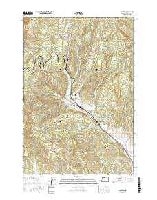
2017 Map of Buxton
USGS Topo · Published 2017About this map
Buxton serves as a central hub in this corner of Washington County, where the Banks-Vernonia State Trail follows a historic rail alignment through the landscape. The geography is defined by a series of deep drainages including Hares Canyon, Poliwaski Canyon, and Paisley Canyon, which feed into the wider basin of W Fork Dairy Cr. Local history is anchored by sites such as the Buxton Cem and Hayward Cem, serving the rural community near the settlement of Hayward. Small-scale aviation and water management are evident through facilities like Apple Valley Airport and several engineered bodies of water, including Green Valley Reservoir, Schmadeke Reservoir, and Whiteman Pond. The northern reaches of the map rise toward Green Mtn, while Wildcat Mtn and Eagle Peak stand as prominent landmarks to the west.
Find a feature on this map
84 named features on this map. Tap any name to fly to it.
Don’t see what you’re looking for? This feature index may not catch every label — zoom into the map to look around manually.
Map Details
Editions of this 2017 Buxton Map
This is the sole edition of this map. No revisions or reprints were ever made.
Other maps of this area

1940 · Vernonia
USGS Topo · 1:62,500

1941 · Keasey
USGS Topo · 1:62,500

1941 · Timber
USGS Topo · 1:62,500

1941 · Gales Creek
USGS Topo · 1:62,500

1943 · Vernonia
USGS Topo · 1:62,500

1943 · Keasey
USGS Topo · 1:62,500

1948 · Vancouver
USGS Topo · 1:250,000

1950 · Vancouver
USGS Topo · 1:250,000

1950 · Vancouver
USGS Topo · 1:250,000

1955 · Timber
USGS Topo · 1:62,500