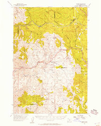
1955 Map of Timber
USGS Topo · Published 1957About this map
The timber industry and rail transport define the landscape of the Northern Oregon Coast Range in the mid-1950s. The Southern Pacific railroad snakes through the rugged terrain, passing through the mountain settlements of Timber and Cochran. This era captures a transition in forest management and habitation, evidenced by the presence of Rogers Forest Camp alongside a Logging Camp (Aband) and remote outposts like Timbuktu and McNamers Camp.
Find a feature on this map
60 named features on this map. Tap any name to fly to it.
Don’t see what you’re looking for? This feature index may not catch every label — zoom into the map to look around manually.
Map Details
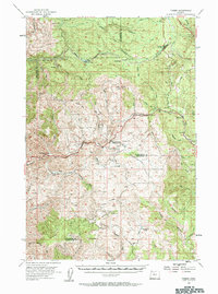
Editions of this 1955 Timber Map
2 editions found
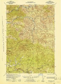
Other maps of this area

1937 · Enright
USGS Topo · 1:62,500

1939 · Saddle Mountain
USGS Topo · 1:62,500

1940 · Vernonia
USGS Topo · 1:62,500

1941 · Keasey
USGS Topo · 1:62,500

1941 · Timber
USGS Topo · 1:62,500

1941 · Enright
USGS Topo · 1:62,500

1941 · Gales Creek
USGS Topo · 1:62,500

1941 · Yamhill
USGS Topo · 1:62,500
1942 · Ginger Peak
USGS Topo · 1:62,500

1942 · Yamhill
USGS Topo · 1:62,500