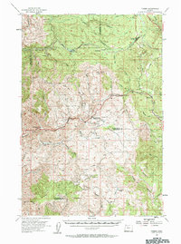
1955 Map of Timber
USGS Topo · Published 1963About this map
Timber stands at the confluence of the Nehalem River and Lousignont Creek, serving as a focal point for the mountain-and-forest economy of the mid-1950s. The Southern Pacific railroad snakes through the northern hills, passing through the high-altitude settlement at Cochran before descending toward the coast. This geography is defined by its deep drainages and forestry outposts, including McNamers Camp and Rogers Forest Camp situated along the high divides. Significant logging infrastructure is evident in the inclusion of Logging Camp (Aband) and remote points like Timbuktu. The landscape is a network of fire roads and ridgelines, from Saddle Mtn in the south to the lookout atop Round Top, reflecting an era of intensive timber management and rugged extraction before modern reforestation reshaped the Coast Range peaks.
Find a feature on this map
51 named features on this map. Tap any name to fly to it.
Don’t see what you’re looking for? This feature index may not catch every label — zoom into the map to look around manually.
Map Details
Editions of this 1955 Timber Map
2 editions found

Other maps of this area

1937 · Enright
USGS Topo · 1:62,500

1939 · Saddle Mountain
USGS Topo · 1:62,500

1940 · Vernonia
USGS Topo · 1:62,500

1941 · Keasey
USGS Topo · 1:62,500

1941 · Timber
USGS Topo · 1:62,500

1941 · Enright
USGS Topo · 1:62,500

1941 · Gales Creek
USGS Topo · 1:62,500

1941 · Yamhill
USGS Topo · 1:62,500

1942 · Ginger Peak
USGS Topo · 1:62,500

1942 · Yamhill
USGS Topo · 1:62,500