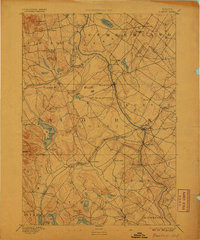
1893 Map of Buxton
USGS Topo · Published 1906About this map
The Saco River serves as the central artery of this late 19th-century landscape, carving through the boundary between Cumberland Co. and York County. The river’s power is reflected in a dense concentration of industrial settlements, including Bar Mills, Salmon Falls, and Union Falls, where the water was harnessed for early New England milling operations. In the western reaches, the Little Ossipee River meanders toward North Waterboro, while the Portland and Rochester Railroad provides a vital inland transit corridor through Hollis Center and South Hollis. To the south, the historic Shaker Village sits near Shaker Pond, marking a distinct communal settlement pattern. The map reveals a highly developed network of small manufacturing hubs and post offices such as Nasons Mills and Goodwins Mills, illustrating the peak of the region's river-and-rail economy before the widespread shifts of the twentieth century.
Find a feature on this map
60 named features on this map. Tap any name to fly to it.
Don’t see what you’re looking for? This feature index may not catch every label — zoom into the map to look around manually.
Map Details
Editions of this 1893 Buxton Map
3 editions found

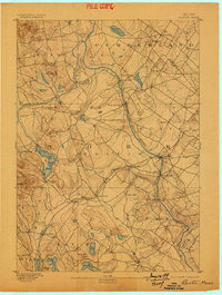
Other maps of this area

1891 · Portland
USGS Topo · 1:62,500

1891 · Biddeford
USGS Topo · 1:62,500

1891 · Berwick
USGS Topo · 1:62,500

1891 · Kennebunk
USGS Topo · 1:62,500

1891 · Buxton
USGS Topo · 1:62,500

1891 · Newfield
USGS Topo · 1:62,500

1892 · Buxton
USGS Topo · 1:62,500

1893 · Kennebunk
USGS Topo · 1:62,500

1893 · Berwick
USGS Topo · 1:62,500

1893 · Biddeford
USGS Topo · 1:62,500