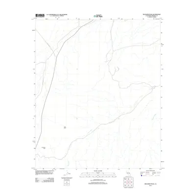
2012 Map of Buzzards Peak
USGS Topo · Published 2012About this map
Gold Basin defines the central depression of this desert landscape in Imperial County, where the terrain is marked by extensive drainage networks including Vinagre Wash and Turnaround Wash. The area is characterized by these broad alluvial fans and washes that carve through the arid basin floor, directed by the topographical prominence of Buzzards Peak in the southwest corner. Transportation through this part of the California desert is facilitated by Blythe Ogilby Rd and Midway Well Rd, which cut through the western portion of the sheet. The spatial relationship between the named peak and the underlying basin provides a clear look at the geomorphology of the region, illustrating how seasonal water runoff has historically shaped the local environment.
Find a feature on this map
6 named features on this map. Tap any name to fly to it.
Don’t see what you’re looking for? This feature index may not catch every label — zoom into the map to look around manually.
Map Details
Editions of this 2012 Buzzards Peak Map
This is the sole edition of this map. No revisions or reprints were ever made.
Other maps of this area

1942 · Blythe
USGS Topo · 1:250,000

1945 · Cibola
USGS Topo · 1:62,500

1945 · Picacho
USGS Topo · 1:62,500

1951 · Picacho
USGS Topo · 1:62,500

1951 · Cibola
USGS Topo · 1:62,500

1953 · Palo Verde Mountains
USGS Topo · 1:62,500

1953 · Quartz Peak
USGS Topo · 1:62,500

1954 · Salton Sea
USGS Topo · 1:250,000
1954 · Picacho NW
USGS Topo · 1:24,000
1954 · Picacho SW
USGS Topo · 1:24,000