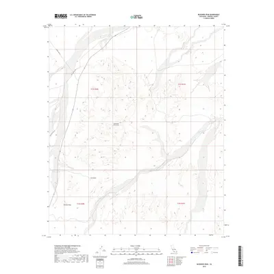
2018 Map of Buzzards Peak
USGS Topo · Published 2018About this map
Chocolate Mountains dominate the interior of this Imperial County landscape, where the dry bed of Vinagre Wash carves through the arid terrain. The map captures a region defined by its isolation and specialized geographic features, such as the prominent summit at Buzzards Peak and the nearby Gold Basin. Transportation through this corner of the desert is facilitated by established routes like Midway Well Rd and Blythe Ogilby Rd, which provide access to the various sections and townships of this rugged survey. This 2018 edition provides an accurate view of the public land survey system and topography before recent shifts in land management or environmental changes in the California desert.
Find a feature on this map
10 named features on this map. Tap any name to fly to it.
Don’t see what you’re looking for? This feature index may not catch every label — zoom into the map to look around manually.
Map Details
Editions of this 2018 Buzzards Peak Map
This is the sole edition of this map. No revisions or reprints were ever made.
Other maps of this area

1942 · Blythe
USGS Topo · 1:250,000

1945 · Cibola
USGS Topo · 1:62,500

1945 · Picacho
USGS Topo · 1:62,500

1951 · Picacho
USGS Topo · 1:62,500

1951 · Cibola
USGS Topo · 1:62,500

1953 · Palo Verde Mountains
USGS Topo · 1:62,500

1953 · Quartz Peak
USGS Topo · 1:62,500

1954 · Salton Sea
USGS Topo · 1:250,000
1954 · Picacho NW
USGS Topo · 1:24,000
1954 · Picacho SW
USGS Topo · 1:24,000