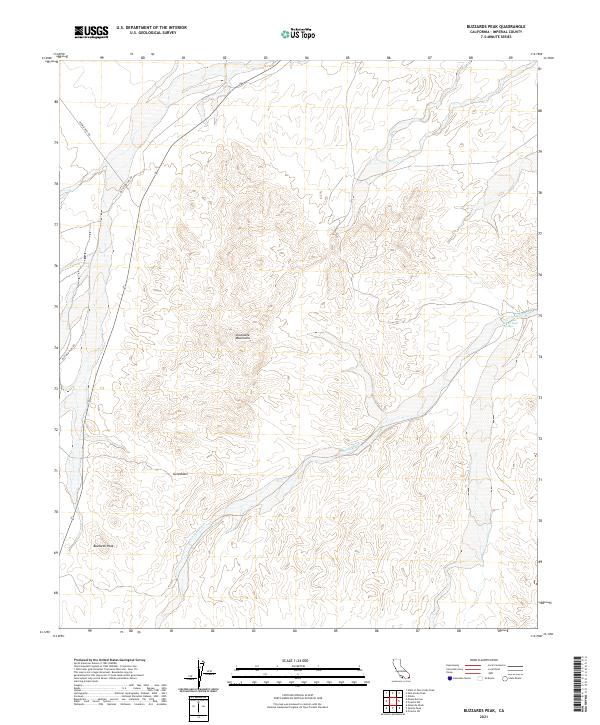
2021 Map of Buzzards Peak
USGS Topo · Published 2021About this map
Chocolate Mountains dominate this arid landscape in Imperial County, where the stark topography of the Colorado Desert is revealed in sharp relief. The terrain is defined by the drainage patterns of Vinagre Wash, which carves through the central and eastern portions of the quadrangle. High points like Buzzards Peak and the depression of Gold Basin suggest a region historically valued for its geological diversity rather than settlement. Transportation through this part of the desert is limited to long-established desert tracks like Midway Well Rd and Blythe Ogilby Rd, which provide access across the basin. The presence of Arrowhead Springs near the eastern edge of the mountains highlights the rare water sources that would have been critical for travelers and early explorers navigating these ranges.
Find a feature on this map
11 named features on this map. Tap any name to fly to it.
Don’t see what you’re looking for? This feature index may not catch every label — zoom into the map to look around manually.
Map Details
Editions of this 2021 Buzzards Peak Map
This is the sole edition of this map. No revisions or reprints were ever made.
Other maps of this area

1942 · Blythe
USGS Topo · 1:250,000

1945 · Cibola
USGS Topo · 1:62,500

1945 · Picacho
USGS Topo · 1:62,500

1951 · Picacho
USGS Topo · 1:62,500

1951 · Cibola
USGS Topo · 1:62,500

1953 · Palo Verde Mountains
USGS Topo · 1:62,500

1953 · Quartz Peak
USGS Topo · 1:62,500

1954 · Salton Sea
USGS Topo · 1:250,000
1954 · Picacho NW
USGS Topo · 1:24,000
1954 · Picacho SW
USGS Topo · 1:24,000