
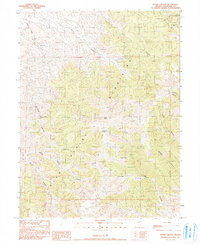
1990 Map of Byers Ranch
USGS Topo · Published 1990About this map
Byers Ranch serves as a primary reference point in this arid stretch of Churchill County, where the desert landscape is defined by the sharp contrast between mountain and basin. The southern edge of the quadrangle is dominated by the Desatoya Mountains, which rise above the surrounding terrain. Drainage patterns are captured through the courses of Edwards Creek and Cedar Creek, which lead toward the expansive Valley and the distinctively marked Dry Lake Shoreline. The presence of a Powerline crossing the southern portion of the map indicates modern infrastructure encroaching on this remote territory. Nearby, the settlement of Edwards sits positioned along the drainage, reflecting the historical importance of water sources for settlement in the Great Basin region.
Find a feature on this map
10 named features on this map. Tap any name to fly to it.
Don’t see what you’re looking for? This feature index may not catch every label — zoom into the map to look around manually.
Map Details
Editions of this 1990 Byers Ranch Map
This is the sole edition of this map. No revisions or reprints were ever made.
Other maps of this area

1955 · Millett
USGS Topo · 1:250,000

1959 · Millett
USGS Topo · 1:250,000

1966 · Clan Alpine Ranch
USGS Topo · 1:62,500

1966 · Edwards Creek Valley
USGS Topo · 1:62,500

1969 · Cold Springs
USGS Topo · 1:24,000

1969 · Carroll Summit NE
USGS Topo · 1:24,000

1969 · Basque Summit
USGS Topo · 1:24,000

1983 · Edwards Creek Valley
USGS Topo · 1:100,000

1985 · Smith Creek Valley
USGS Topo · 1:100,000
1990 · Byers Canyon
USGS Topo · 1:24,000