
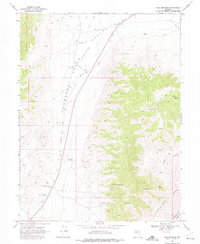
1969 Map of Cold Springs
USGS Topo · Published 1972About this map
Old Overland Road cuts through the high desert of the Desatoya Mts and the vast Edwards Valley, tracing a path used by travelers for decades. This late 1960s survey documents the remnants of early communication and travel networks, specifically the Old Telegraph Station and Old Stage Station. These ruins, located near the modern settlement of Cold Springs, mark the transition from 19th-century infrastructure to the mid-century landscape. To the north, Alpine Ranch occupies a rare pocket of developed land amidst the ridges and canyons.
Find a feature on this map
14 named features on this map. Tap any name to fly to it.
Don’t see what you’re looking for? This feature index may not catch every label — zoom into the map to look around manually.
Map Details
Editions of this 1969 Cold Springs Map
3 editions found
Other maps of this area

1955 · Millett
USGS Topo · 1:250,000

1959 · Millett
USGS Topo · 1:250,000

1966 · Clan Alpine Ranch
USGS Topo · 1:62,500

1966 · Edwards Creek Valley
USGS Topo · 1:62,500

1969 · Camp Creek Canyon
USGS Topo · 1:24,000

1969 · Desatoya Peak
USGS Topo · 1:24,000

1969 · Carroll Summit
USGS Topo · 1:24,000

1969 · Basque Summit
USGS Topo · 1:24,000

1969 · Eastgate
USGS Topo · 1:24,000

1983 · Edwards Creek Valley
USGS Topo · 1:100,000