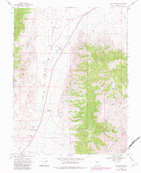
1969 Map of Cold Springs
USGS Topo · Published 1983About this map
The Old Overland Road cuts through this high-desert corridor, tracing a path of historical transportation through Edwards Creek Valley. This 1960s survey provides significant evidence of earlier frontier infrastructure, noting the Old Telegraph Station (Ruins) and the Old Stage Station (Ruins) located along the base of the Desatoya Mts. These sites speak to the era of the Pony Express and transcontinental telegraphy when this region served as a vital link between the East and West.
Find a feature on this map
19 named features on this map. Tap any name to fly to it.
Don’t see what you’re looking for? This feature index may not catch every label — zoom into the map to look around manually.
Map Details
Editions of this 1969 Cold Springs Map
3 editions found
Other maps of this area

1955 · Millett
USGS Topo · 1:250,000

1959 · Millett
USGS Topo · 1:250,000

1966 · Clan Alpine Ranch
USGS Topo · 1:62,500

1966 · Edwards Creek Valley
USGS Topo · 1:62,500

1969 · Camp Creek Canyon
USGS Topo · 1:24,000

1969 · Cold Springs
USGS Topo · 1:24,000

1969 · Desatoya Peak
USGS Topo · 1:24,000

1969 · Carroll Summit
USGS Topo · 1:24,000

1969 · Basque Summit
USGS Topo · 1:24,000

1969 · Eastgate
USGS Topo · 1:24,000