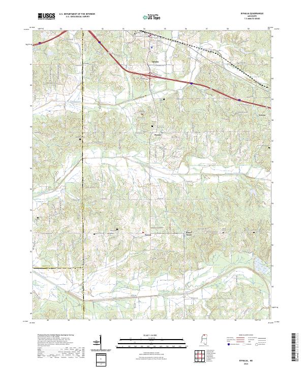
2024 Map of Byhalia
USGS Topo · Published 2024About this map
Byhalia serves as the primary hub in this northern Mississippi landscape, where modern transportation corridors intersect with deeply rooted rural settlements. The terrain is defined by a dense network of watercourses, including Byhalia Creek and the Red Banks Creek Canal, which illustrate the region's managed drainage and agricultural history. Local family and community landmarks are prominent, notably near Warsaw and Watson Center, where numerous burial grounds like Watkins Cem and Saint Pauls Cem offer significant touchpoints for genealogical research. The map captures the meeting of three counties—Marshall, DeSoto, and Tate—highlighting the area's importance as a regional crossroads. Rural homesteads and historical developments are linked by an extensive road system, from Myers Plantation Rd to Rabbit Ridge Rd, reflecting the evolution of land use from early plantations to modern residential and agricultural parcels.
Find a feature on this map
108 named features on this map. Tap any name to fly to it.
Don’t see what you’re looking for? This feature index may not catch every label — zoom into the map to look around manually.
Map Details
Editions of this 2024 Byhalia Map
This is the sole edition of this map. No revisions or reprints were ever made.
Other maps of this area

1944 · Senatobia
USGS Topo · 1:62,500

1944 · Hernando
USGS Topo · 1:62,500

1944 · Tyro
USGS Topo · 1:62,500

1948 · Byhalia
USGS Topo · 1:62,500

1956 · Tupelo
USGS Topo · 1:250,000

1958 · Tupelo
USGS Topo · 1:250,000
1971 · Byhalia
USGS Topo · 1:24,000
1971 · Marianna
USGS Topo · 1:24,000

1971 · Wyatte
USGS Topo · 1:24,000
1971 · Red Banks
USGS Topo · 1:24,000