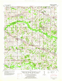
1948 Map of Byhalia
USGS Topo · Published 1960About this map
Byhalia serves as the central hub of this 1940s landscape, where the ST Louis And San Francisco railroad cuts a diagonal line through the northern Mississippi countryside. The area is defined by a dense network of small rural communities and church-centered settlements including Victoria, Red Banks, and Watson. The topography is shaped by the winding course of the Coldwater River and its numerous tributaries like Nonconnah Creek and Pigeon Roost Creek, creating a complex drainage pattern that influenced the placement of early homesteads and family cemeteries.
Find a feature on this map
118 named features on this map. Tap any name to fly to it.
Don’t see what you’re looking for? This feature index may not catch every label — zoom into the map to look around manually.
Map Details
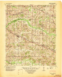
Editions of this 1948 Byhalia Map
3 editions found
Other maps of this area

1943 · Collierville
USGS Topo · 1:62,500

1944 · Senatobia
USGS Topo · 1:62,500

1944 · Hernando
USGS Topo · 1:62,500

1944 · Tyro
USGS Topo · 1:62,500

1944 · Potts Camp
USGS Topo · 1:62,500

1945 · Potts Camp
USGS Topo · 1:62,500

1948 · Byhalia
USGS Topo · 1:62,500

1949 · Moscow
USGS Topo · 1:62,500

1953 · Holly Springs
USGS Topo · 1:62,500

1953 · Collierville
USGS Topo · 1:50,000