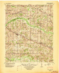
1948 Map of Byhalia
USGS Topo · Published 1950About this map
The ST Louis San Francisco railroad corridor dictates the economic axis of north-central Mississippi in this post-war era, connecting the significant settlements of Byhalia and Victoria. This landscape is exceptionally dense with rural community institutions, evidenced by the frequent occurrence of combined school and church sites like Eason Ch & Sch and New Hope Ch & Sch. These clusters reflect a traditional Southern settlement pattern where social life centered on small, decentralized nodes of faith and education often named for local families.
Find a feature on this map
111 named features on this map. Tap any name to fly to it.
Don’t see what you’re looking for? This feature index may not catch every label — zoom into the map to look around manually.
Map Details
Editions of this 1948 Byhalia Map
3 editions found
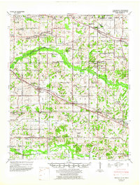
Other maps of this area

1943 · Collierville
USGS Topo · 1:62,500

1944 · Senatobia
USGS Topo · 1:62,500

1944 · Hernando
USGS Topo · 1:62,500

1944 · Tyro
USGS Topo · 1:62,500

1944 · Potts Camp
USGS Topo · 1:62,500

1945 · Potts Camp
USGS Topo · 1:62,500

1948 · Byhalia
USGS Topo · 1:62,500

1949 · Moscow
USGS Topo · 1:62,500

1953 · Holly Springs
USGS Topo · 1:62,500

1953 · Collierville
USGS Topo · 1:50,000