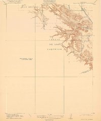
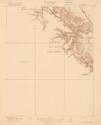
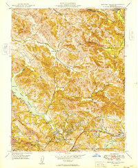
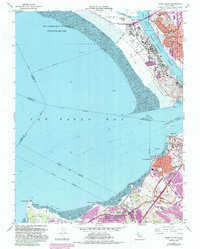
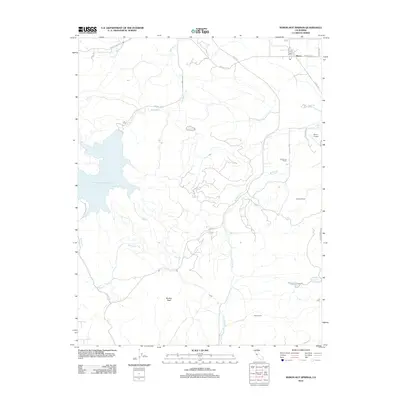
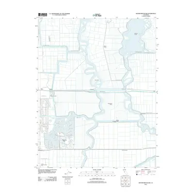
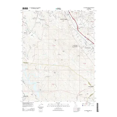
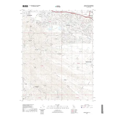
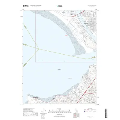
1916 Map of Byron Hot Springs
USGS Topo · Published 1922About this map
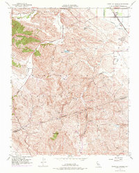
Byron Hot Springs serves as the focal point of this 1910s era study, situated at the eastern edge of the coastal range where the foothills meet the flatlands of the San Joaquin Valley. This particular survey is unusual for its large Preliminary Edition Unsurveyed Area, leaving much of the western portion blank while providing high-resolution topographic detail for the populated corridor to the east. The settlement of Byron is positioned along the Southern Pacific railroad line, which served as the primary transit artery for the region's agricultural and resort interests. The landscape is defined by the historic land grants of Canada De Los Vaqueros and Los Meganos, with drainage provided by Kellogg Creek and Brushy Creek. The map records the interface between Contra Costa and Alameda counties, capturing the transition from undeveloped ranch lands to the early twentieth-century rail-head economy.
Find a feature on this map
10 named features on this map. Tap any name to fly to it.
Don’t see what you’re looking for? This feature index may not catch every label — zoom into the map to look around manually.
Map Details
Editions of this 1916 Byron Hot Springs Map
2 editions found
Historical Maps of Byron Through Time
58 maps found

1896 Mt. Diablo
Contra Costa County, CA
1898 Mt. Diablo
Contra Costa County, CA

1911 Byron Hot Springs
Contra Costa County, CA

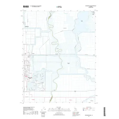
1913 Woodward Island
Contra Costa County, CA
1916 Byron Hot Springs
Contra Costa County, CA
1916 Lone Tree Valley
Contra Costa County, CA

1943 Mt. Diablo
Contra Costa County, CA

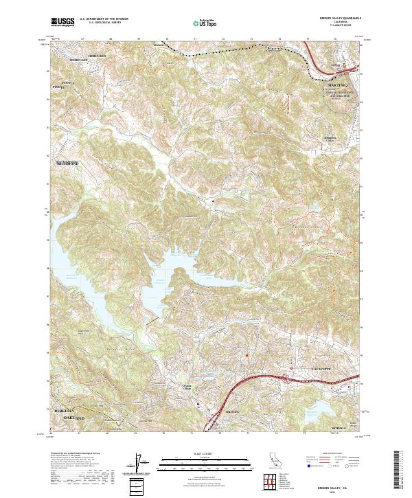
1947 Briones Valley
Contra Costa County, CA

1947 Las Trampas Ridge
Contra Costa County, CA
1949 Briones Valley
Contra Costa County, CA

1949 Las Trampas Ridge
Contra Costa County, CA

1949 Mare Island
Contra Costa County, CA

1951 Mare Island
Contra Costa County, CA
1951 Port Chicago
Contra Costa County, CA
1952 Woodward Island
Contra Costa County, CA
1953 Antioch South
Contra Costa County, CA
1953 Byron Hot Springs
Contra Costa County, CA
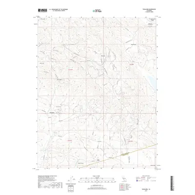
1953 Tassajara
Contra Costa County, CA
1959 Briones Valley
Contra Costa County, CA
1959 Las Trampas Ridge
Contra Costa County, CA
1959 Mare Island
Contra Costa County, CA
1968 Port Chicago
Contra Costa County, CA

1978 Woodward Island
Contra Costa County, CA

1991 Tassajara
Contra Costa County, CA

1993 Briones Valley
Contra Costa County, CA

1993 Las Trampas Ridge
Contra Costa County, CA

1995 Briones Valley
Contra Costa County, CA

1995 Las Trampas Ridge
Contra Costa County, CA

1996 Tassajara
Contra Costa County, CA
2012 Antioch South
Contra Costa County, CA
2012 Briones Valley
Contra Costa County, CA
2012 Byron Hot Springs
Contra Costa County, CA
2012 Las Trampas Ridge
Contra Costa County, CA
2012 Mare Island
Contra Costa County, CA
2012 Tassajara
Contra Costa County, CA
2012 Woodward Island
Contra Costa County, CA
2015 Antioch South
Contra Costa County, CA
2015 Briones Valley
Contra Costa County, CA
2015 Byron Hot Springs
Contra Costa County, CA
2015 Las Trampas Ridge
Contra Costa County, CA
2015 Mare Island
Contra Costa County, CA
2015 Tassajara
Contra Costa County, CA
2015 Woodward Island
Contra Costa County, CA
2018 Antioch South
Contra Costa County, CA
2018 Briones Valley
Contra Costa County, CA
2018 Byron Hot Springs
Contra Costa County, CA
2018 Las Trampas Ridge
Contra Costa County, CA
2018 Mare Island
Contra Costa County, CA
2018 Tassajara
Contra Costa County, CA
2018 Woodward Island
Contra Costa County, CA

2021 Antioch South
Contra Costa County, CA
2021 Briones Valley
Contra Costa County, CA
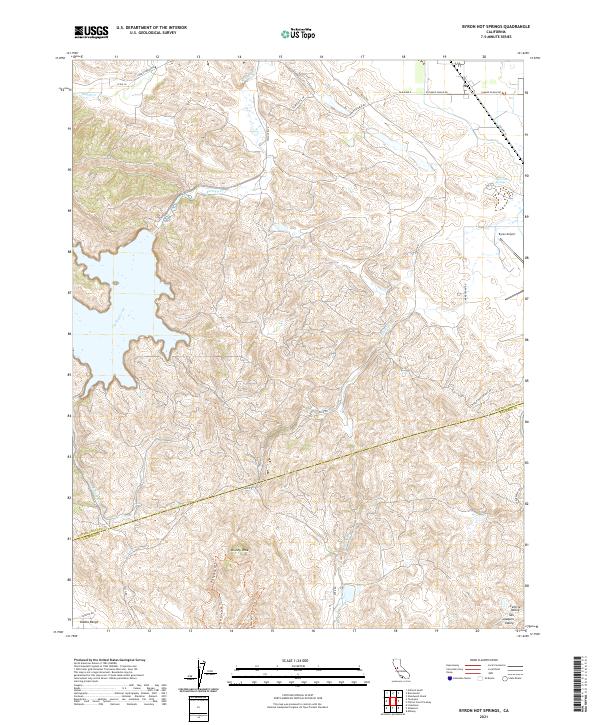
2021 Byron Hot Springs
Contra Costa County, CA
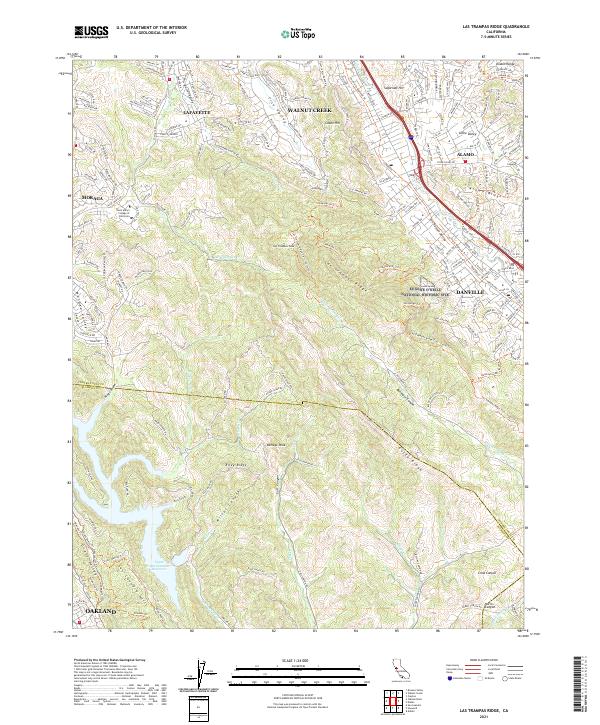
2021 Las Trampas Ridge
Contra Costa County, CA

2021 Mare Island
Contra Costa County, CA
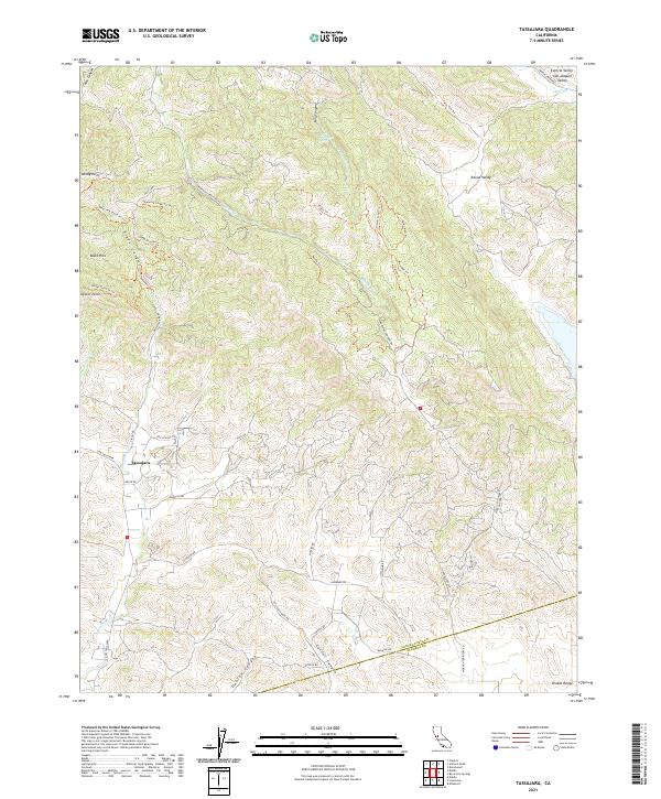
2021 Tassajara
Contra Costa County, CA

2021 Woodward Island
Contra Costa County, CA

2023 Antioch South
Contra Costa County, CA