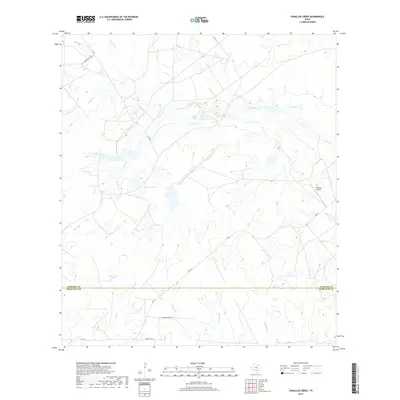
2019 Map of Caballos Creek
USGS Topo · Published 2019About this map
The boundary between Atascosa Co and McMullen Co bisects this southern Texas landscape, defined by a network of ephemeral streams and cattle tanks. The terrain is characterized by the winding paths of La Parita Cr, Macho Cr, and Turkey Cr, which drain toward broader basins like Lake Number 1 and Lake Number 2. This region reflects a rural economy dependent on water management, as evidenced by the numerous named catchments such as Caballos Tank, Lewis Tank, and Government Tank. Ranching heritage is deeply embedded in the local geography, seen in the presence of the 74 Ranch Airport and roads like Peeler Ranch Rd and Mrs Smyer's Rd. This 2019 survey documents a landscape of large-scale landholdings where traditional ranching infrastructure meets modern aviation, all shaped by the intricate hydrology of the Caballos Cr watershed.
Find a feature on this map
24 named features on this map. Tap any name to fly to it.
Don’t see what you’re looking for? This feature index may not catch every label — zoom into the map to look around manually.
Map Details
Editions of this 2019 Caballos Creek Map
This is the sole edition of this map. No revisions or reprints were ever made.
Other maps of this area

1925 · Crowther No. 3
USGS Topo · 1:48,000

1930 · Whitsett
USGS Topo · 1:62,500

1942 · Whitsett
USGS Topo · 1:62,500

1953 · Crystal City
USGS Topo · 1:250,000

1955 · Crystal City
USGS Topo · 1:250,000

1956 · Pleasanton
USGS Topo · 1:62,500

1956 · Jourdanton
USGS Topo · 1:62,500

1956 · Franklin Settlement
USGS Topo · 1:62,500

1961 · Crystal City
USGS Topo · 1:250,000
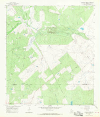
1965 · Caballos Creek
USGS Topo · 1:24,000